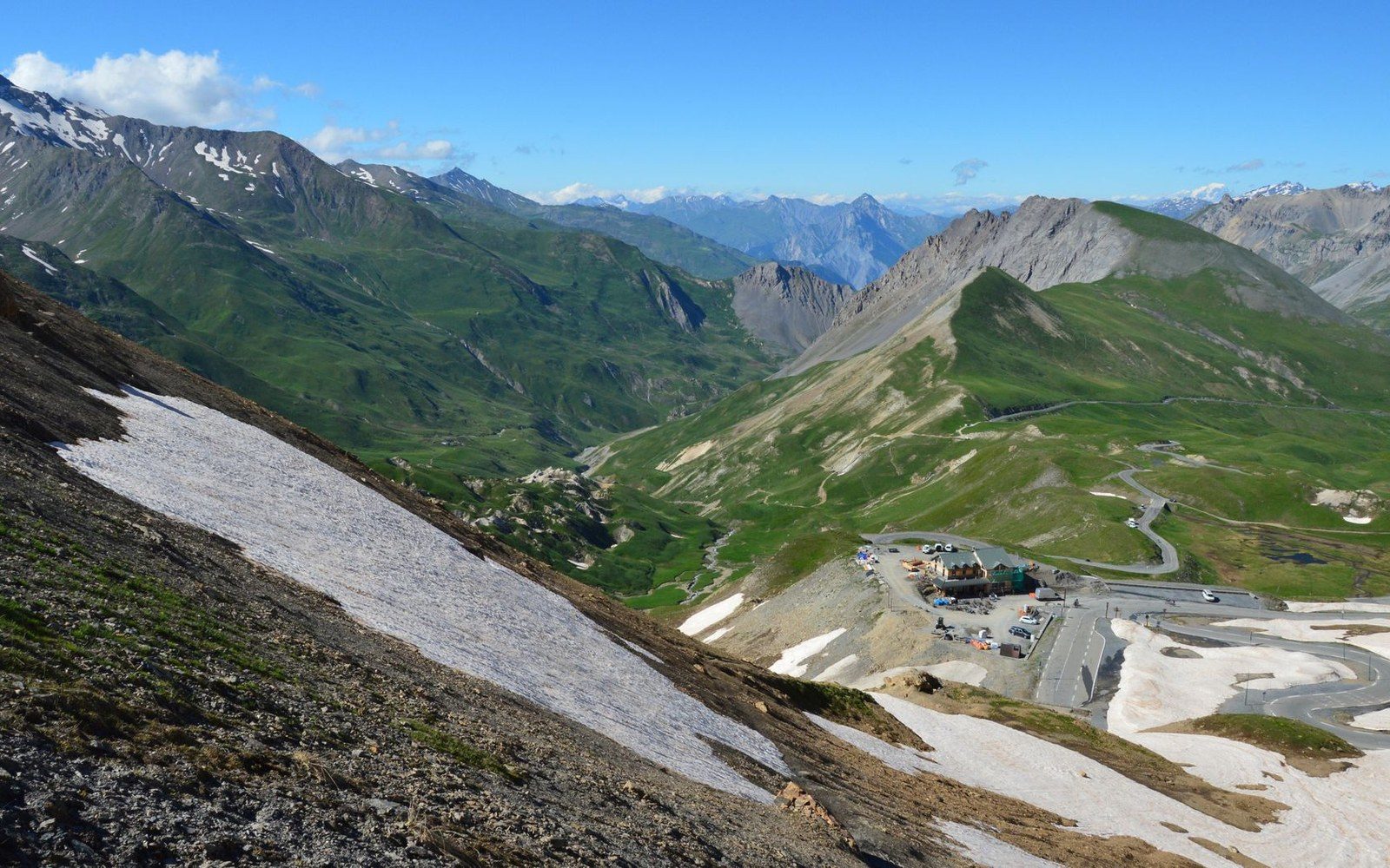
The last kilometres to the col, where the road stops pretending to be a road.
Photo: SlimMars 13 / Pexels
The Galibier Is a Road That Admits It Should Not Be There
The Col du Galibier sits at 2,642 metres in the Graian Alps, carrying a road that required a tunnel, a gallery and decades of repair to stay open. Every feature of the route — the hairpins, the avalanche shelters, the winter closure — is engineering's acknowledgement that the mountain resists passage.
The Road and What It Cost to Build It
The departmental route linking Saint-Michel-de-Maurienne on the valley floor to Briançon across the watershed was completed in 1879, its highest point the Col du Galibier at what the Institut Géographique National records as 2,642 metres. The road climbs from the Maurienne via the Col du Télégraphe at 1,566 metres before descending briefly to Valloire and then rising again — a double ascent that the cyclists who come later will always note with feeling. From Valloire to the col, the road gains roughly 1,200 metres in under eighteen kilometres, averaging gradients that regularly exceed eight percent and spike to more than ten on the northern hairpins below the summit.
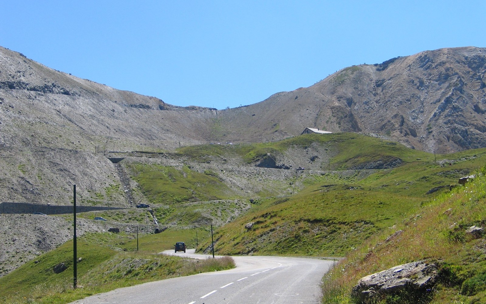
Desgrange sent the race over this to prove the road was passable.
Photo: Galibier · Wikimedia Commons
The difficulty was not gradient alone. The terrain on the northern face sweeps avalanche debris across the road through winter and into early summer. The engineering answer was a tunnel bored beneath the true summit, completed in 1891 — decades before the pass first appeared in the Tour de France, in 1911. The tunnel carries traffic under the final ridge at approximately 2,556 metres, bypassing the exposed col proper. Even so, it closes for winter; the snow-clearance convoy that opens the Galibier each year is among the more demanding on the Savoyard calendar, deploying rotary snowploughs — machines with a rotating cutting head that ejects compacted snow laterally — on gradients that make the work genuinely hazardous.
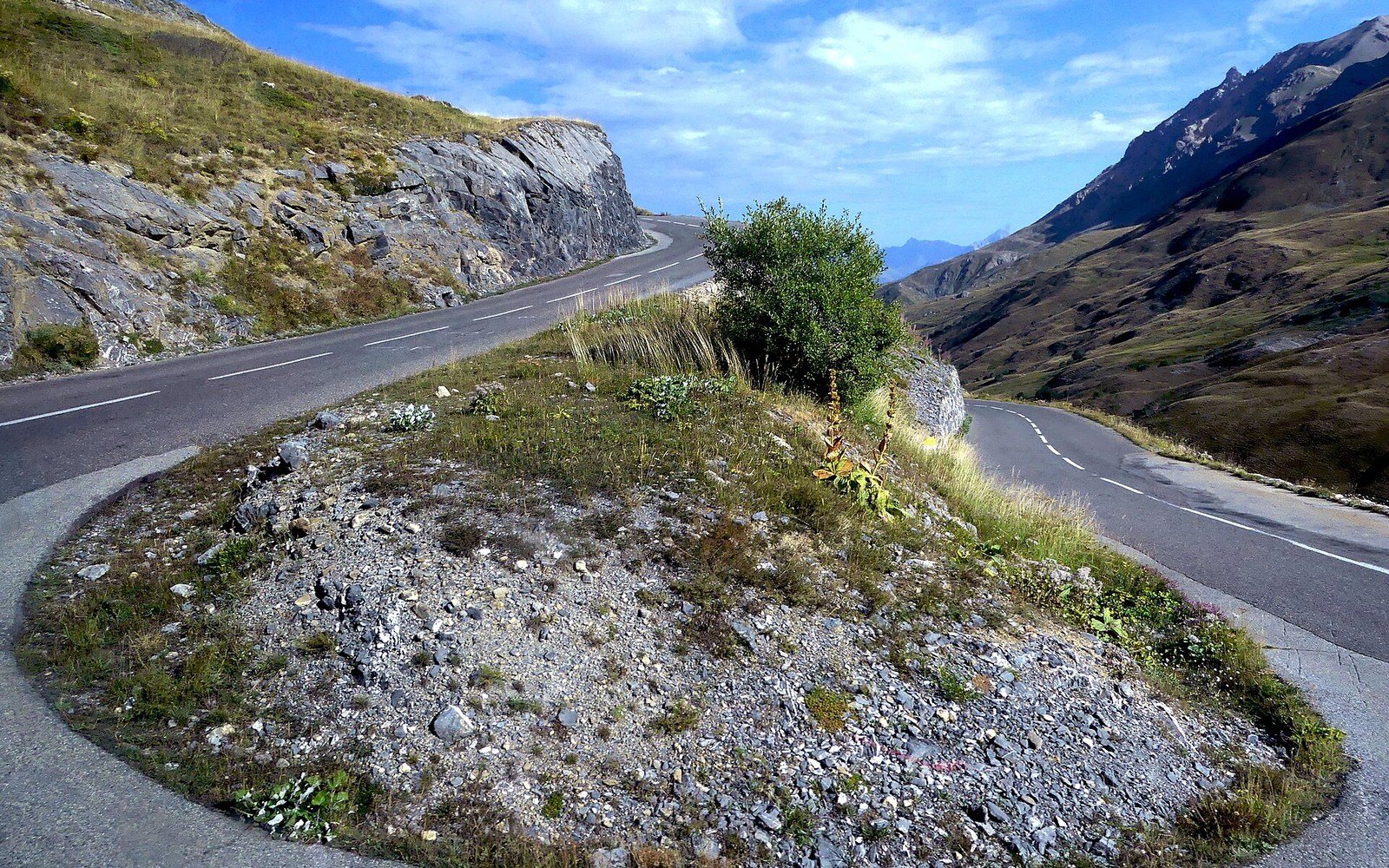
The switchback ladder below the tunnel: every bend buys height a straight line could not.
Photo: Lacet Route du Col du Galibier à Valloire (septembre 2024) · Wikimedia Commons
Above the tunnel's northern mouth, a side road of about a kilometre climbs to the col itself at 2,642 metres. This upper section is narrower, less maintained and closed to heavy vehicles. It exists, in the road's own logic, as an admission: the route at altitude is provisional, managed, always conditional on the season. A reinforced avalanche gallery — a concrete or stone structure built over the road so that debris passes over rather than onto it — protects the most exposed section below the tunnel entrance on the northern approach. The gallery is not decorative; the event it guards against is documented, recurrent and precisely located.
Desgrange, Coppi and the Race That Made It Famous
Henri Desgrange, the founder and first director of the Tour de France, sent the race over the Galibier in 1911, the first year the col featured in the modern stage format. He had already written about the pass with a reverence bordering on theatre — but it was the infrastructure that made the decision, not sentiment. The road of 1879 was, by 1911, the only paved route across the watershed in this sector, and Desgrange understood, as the Tour's early history repeatedly demonstrates, that racing over a road was also an argument for its maintenance. The monument to Desgrange, a stone marker erected near the col's summit, was placed there after his death in 1940; that a race director was commemorated on the road's hardest summit is legible as an architectural statement as much as a biographical one.
The race's relationship with the Galibier accumulated a record of suffering that is almost entirely physical in its documentation. Fausto Coppi crossed first in 1952, alone, in a stage from Bourg-d'Oisans that the race's own official records ↗ credit as among the defining Alpine performances of the postwar Tour. Coppi had attacked on the lower slopes, dropped the field and rode the Galibier in a condition of determined solitude that became, in Tour history, something close to emblematic. What the records show is the time gap at the summit: several minutes on the next rider, extended further on the descent to Briançon. What the road shows is why such gaps are possible — the hairpin sequence below the col is a ladder of isolated efforts, each bend its own small crisis of traction and oxygen, each offering a view back down the valley that tells the rider exactly how much height separates them from the pack.
Col du Galibier on the valley's own geometry, with the neighbouring cols for scale.
Geometry: IGN / project map kit
The modern stage record stands, as of recent editions, as evidence that the road has not changed much while the athletes have. The gradient profile that defeated early Tour pelotons on heavy steel bicycles is the same profile ridden now on carbon frames at speeds that would have been implausible in Coppi's era, yet the Galibier still fractures fields at the same points on the same hairpins. The road's geometry is fixed by the terrain; only the machinery and the physiology vary.
Engineering as Argument
Reading the Galibier as infrastructure rather than scenery clarifies what is otherwise treated as atmosphere. The tunnel of 1891 is not a shortcut but a structural concession — the summit route is impassable by wheeled traffic for most of the year, and the tunnel extended the season by several weeks in each direction. Even with the tunnel, the road is typically closed from November to May or June depending on snowfall, a period longer than it is open. The maintenance cost of keeping the road viable between openings — patching frost-heave damage to the carriageway, clearing debris from the gallery approaches, inspecting the tunnel lining — is a recurring departmental expense absorbed into the management of a route that earns its keep mainly in the summer months.
The hairpin count on the north face is not precisely standardised across sources, but the road's published gradient profile confirms that the ascent from Valloire involves a sustained sequence of switchbacks — sharp hairpin bends that reverse direction to gain altitude — across terrain where a straight line would require viaducts the budget of 1879 could not have produced. The result is a road that is longer than the direct distance by a significant margin, every extra kilometre a negotiation with slope angle. That is visible from the valley: a traveller on the Maurienne floor looking east and south toward the watershed can sometimes pick out the ribbon of tarmac zigzagging in sunlight against the rock, each hairpin a documented compromise between what the engineers wanted and what the mountain permitted.
The Galibier is, in this reading, not exceptional — it is the clearest statement of a logic that runs through every high col road in the Savoyard Alps, from the Col de la Croix de Fer to the Col de l'Iseran. But the Galibier states it most plainly. The tunnel admits the summit cannot be crossed reliably. The gallery admits debris will arrive. The winter closure admits the road is seasonal. And the monument to Desgrange admits that the road would not be there without a sustained act of will against the mountain's own preference, which is to have no road at all.
Chronology
- 1879Galibier road completed, linking Maurienne valley to Briançon
- 1891Summit tunnel completed
- 1911First Tour de France stage crossing in modern format; Henri Desgrange sends the race over the col
- 1940Desgrange dies; a stone monument is later erected near the col's summit in his memory
- 1952Fausto Coppi crosses first on a Bourg-d'Oisans stage, extending his gap over several minutes at the summit